Kidzone Geography
Brazil Index
Brazil Geography Facts
Brazil History Facts
Brazil Activities
Brazil Photos
KidZone Geography: Brazil
Amazonas
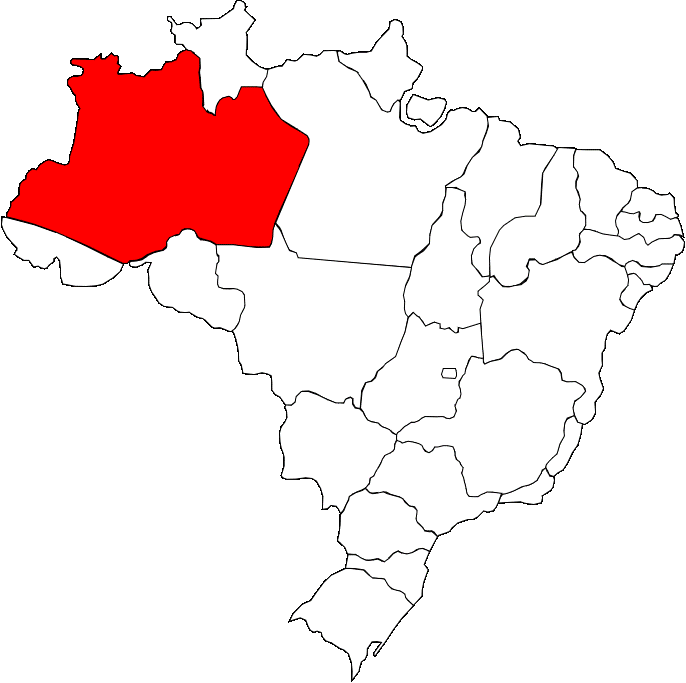
A map of Amazonas, showing where it is in Brazil
Amazonas is the largest state in Brazil and has international borders with Peru, Colombia and Venezuela. The state is almost entirely covered by rainforest and is home to Brazils highest mountain Pico de Neblina at 2994 meters. Throughout colonial history, Spainish control and religious missions dominate. Due to this in part, deforestation and slavery have long plagued the area. A large portion of the modern population arrived during the ruber boom and today the state capital Manaus is home to 17 million people. The state is hot and humid all year round with industry as a major busines.